Skiing the Wapack in the 1970s
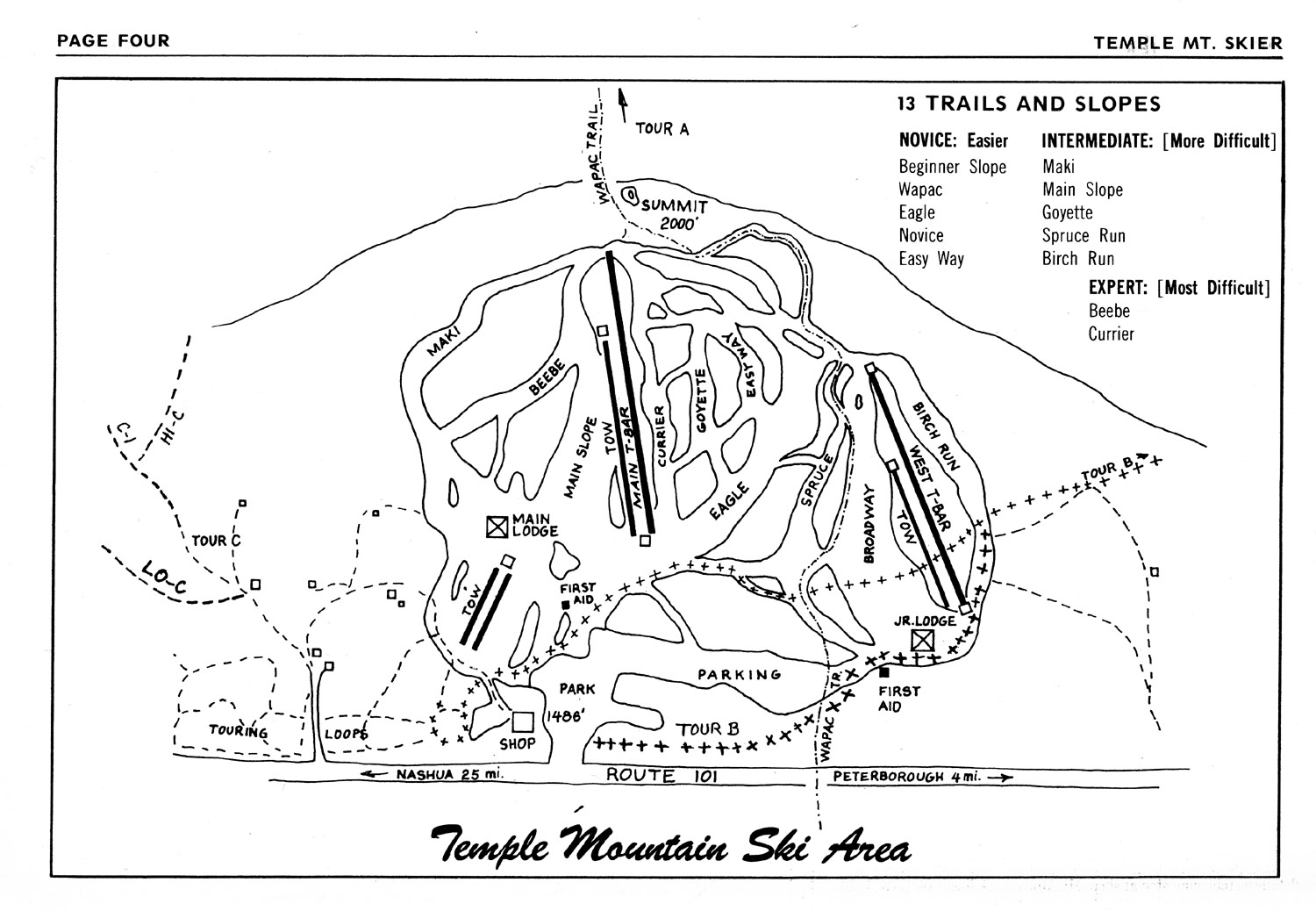
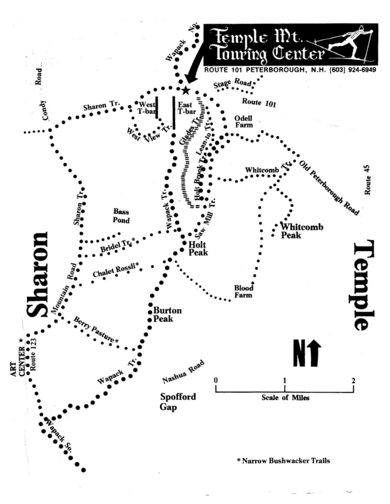
The 70s were a prime time to ski the trail. While perhaps it was not as nice as the 30s, when the range was clear, it was a decade with a lot of snow, and with three cross country ski areas that provided easy access to the higher terrain. Our favorite trip was to start at the Temple Mountain ski area, where we paid $1 in the early 70s, which went up to $3 as time went on, for a single ride up the west T-bar. From there, it was easy to access the Wapack Trail at the summit and to ski south. There were only a couple of difficult spots. One was the steep bit south of Holt Peak, typically done by dragging poles and usually with a fall about halfway down. The hardest part was the final quarter mile down to the road in Sharon, a combination of turns, snowplows and, yes, falls. (Remember that this was all on wood skis with three pin bindings and thin leather boots.) We then walked along Temple Road west to Mountain Road, where we put our skis back on and skied north almost to route 101. Just before that road, there was a trail that took us back to the Temple Mountain parking lot. Temple had, for a few years, a network of cross country trails, mostly near the top of the ski lifts, as best I can remember. We skied those a couple of times as well. They were snowmobile groomed.
A second trip was to start at Windblown and ski up to the Wapack Trail near the shelter at the top of the Open Slope on Barrett Mountain. From there, it was easy skiing across Barrett Mountain. The descent to the Barrett-New Ipswich col was straightforward; it was a steep grunt out of the col south for a few hundred feet, and then a gradual climb to the summit of New Ipswich. The descent down to the New Ipswich-Pratt col was a bit steep but quite open, so you could traverse back and forth. The climb up to Pratt was mostly ok; we would go as far as the outlook over Binney Pond. We’d ski back to Windblown the same way we had come. The views were very open, more than today, in part because of few and shorter trees, and in part because there were several feet of snow on the ground that got you up higher than on summer hikes. We skied the trails at Windblown too, of course, starting in 1974 (I think), when the area first opened.
The third trip was to start at the Watatic Mountain ski area, which had some cross country ski trails in the 70s and early 80s. Some of those trails are still walkable today; they are old woods roads. We’d ski up one of them to the Wapack Trail, and then go south over Nutting Hill and to the Watatic summit—not too hard. Once in a while we’d ski the Midstate down to route 119. We’d then turn around and ski north to the Binney Hill Road and to Binney Pond. You could generally ski on the pond, which was frozen solid and had a nice covering of snow. One time we skied a few hundred feet up the steep stretch north of the pond, with a desperate descent. We’ve never skied the rest of the steep part to the Binney Pond overlook. The Watatic trip was the easiest skiing of the three options, which is why, since we were in our 20s, we skied it the least frequently.
A final favorite ski trip, not on the Wapack, was to go up Winn Mountain in Lyndeborough. Back in the 70s, you could park near the top of Joslin Road and ski up a set of woods roads and open fields to the summit. It was a great place to bring beginning skiers, since there was nothing too hard. We learned of Winn Mountain from a strange cross country ski guidebook. It was small format; the paper was almost newsprint quality. The guidebook was discarded during a periodic housecleaning years ago, though I wish I had kept it, since that ski (and hiking) route is closed today.
— George Kocur