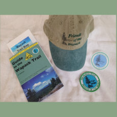
Wapack Trail Map
$8.00
Wapack Trail Map – Our full color, waterproof and tear resistant Wapack Trail Map is two sided and includes descriptive text that explains the route, elevations, gradient lines, mileage and trail profiles. This Map is the definitive detailed information source for The Wapack Trail.
Split between the North and South sections of the Trail is details the trails to the following peaks:
North Peaks – Burton Peak, Holt Peak Temple Mountain, Pack Monadnock and North Pack Monadnock Mountain.
South Peaks – Mount Watatic, Pratt Mountain, Stony Top, New Ipswich Mountain, Barrett Mountain and Kidder Mountain.
Fold this map up and take it along on a quick mountain hike or an end-to-end trail run. Mark it up with your notes and have all the information about the Trail that you need for a great adventure along Tthe Wapack Trail.
All proceeds from the sale of the Map supports our efforts to maintain and protect The Wapack Trail.
Additional information
| Weight | 1.44623 oz |
|---|---|
| Dimensions | 7.625 × 4.75 × .25 in |


